As part of the IPA 2021 project “EU Support to the Agricultural Sector in Montenegro”, whose beneficiaries are the Ministry of Agriculture, Forestry and Water Management and the Agriculture, Rural Development and Fisheries Payments Agency, aerial photogrammetric surveying of the territory of Montenegro has commenced.
The project is fully funded by the European Union, while the work is being carried out by the Polish company MGGP Aero under a contract valued at €197,000. The activities are scheduled for completion by the end of September this year.
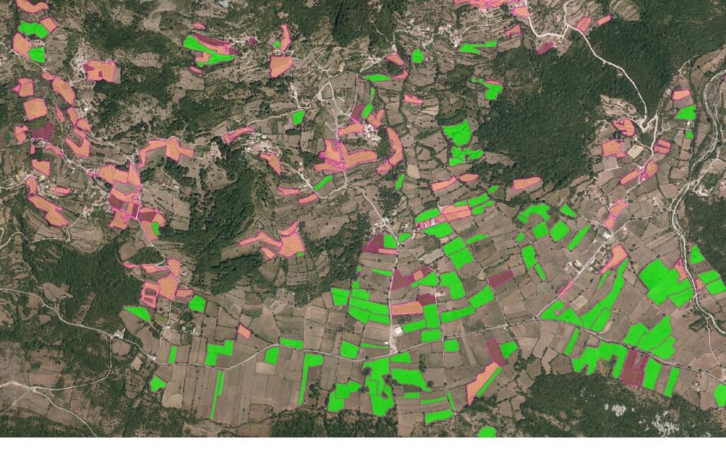
The project will result in new digital orthophotography (DOF) with a resolution of 20 centimetres, as well as a Digital Terrain Model (DTM) of Montenegro with a 5 × 5 metre grid spacing, in accordance with current European Union standards and requirements.
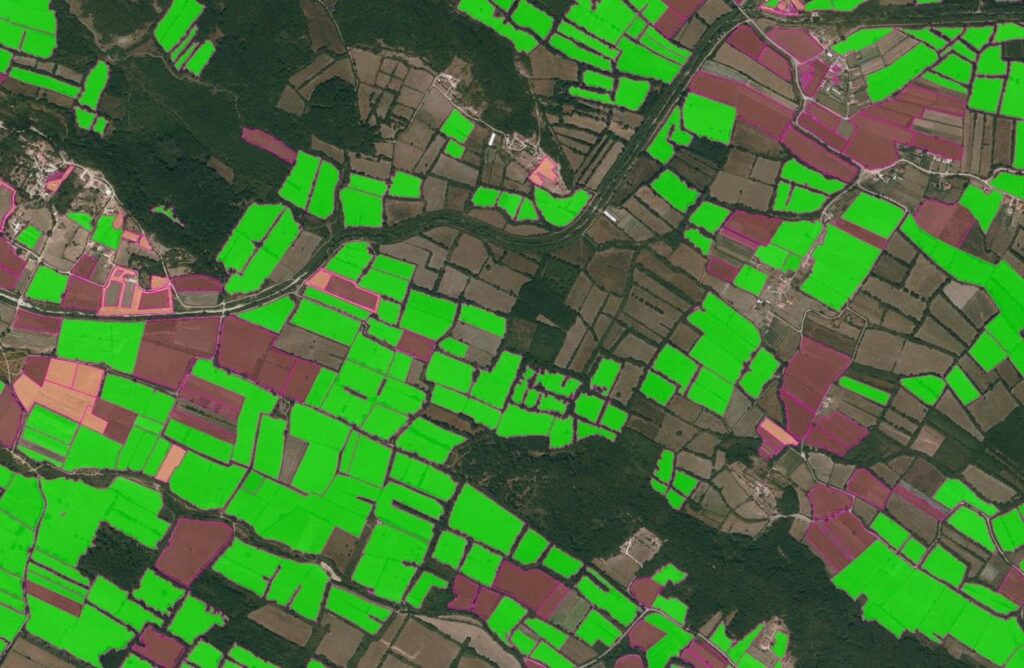
The new data will provide a key foundation for the enhancement of the Land Parcel Identification System (LPIS/SIZEP), as well as the further development of the Integrated Administration and Control System (IACS), both of which are essential for the efficient management of agricultural support schemes and alignment with the European Union’s Common Agricultural Policy.
The updated orthophoto data will enable more accurate identification and monitoring of agricultural parcels, strengthen control mechanisms within the IACS framework, and support more reliable planning and implementation of agricultural policy measures.
In addition to its application in agriculture, the data will also be used in forestry, spatial planning, environmental protection, cartography, and natural resource management.
Upon completion of the project, Montenegro will have an updated digital orthophoto of its national territory, providing state institutions, local authorities, and other users with a high-quality, reliable geospatial information base for planning, management, and decision-making.
Source: gov.me


